
Redson Dev brief · PRIMARY SOURCE
Putting Earth AI to work: Geospatial agents for our planet's biggest challenges
Google Research · October 14, 2026
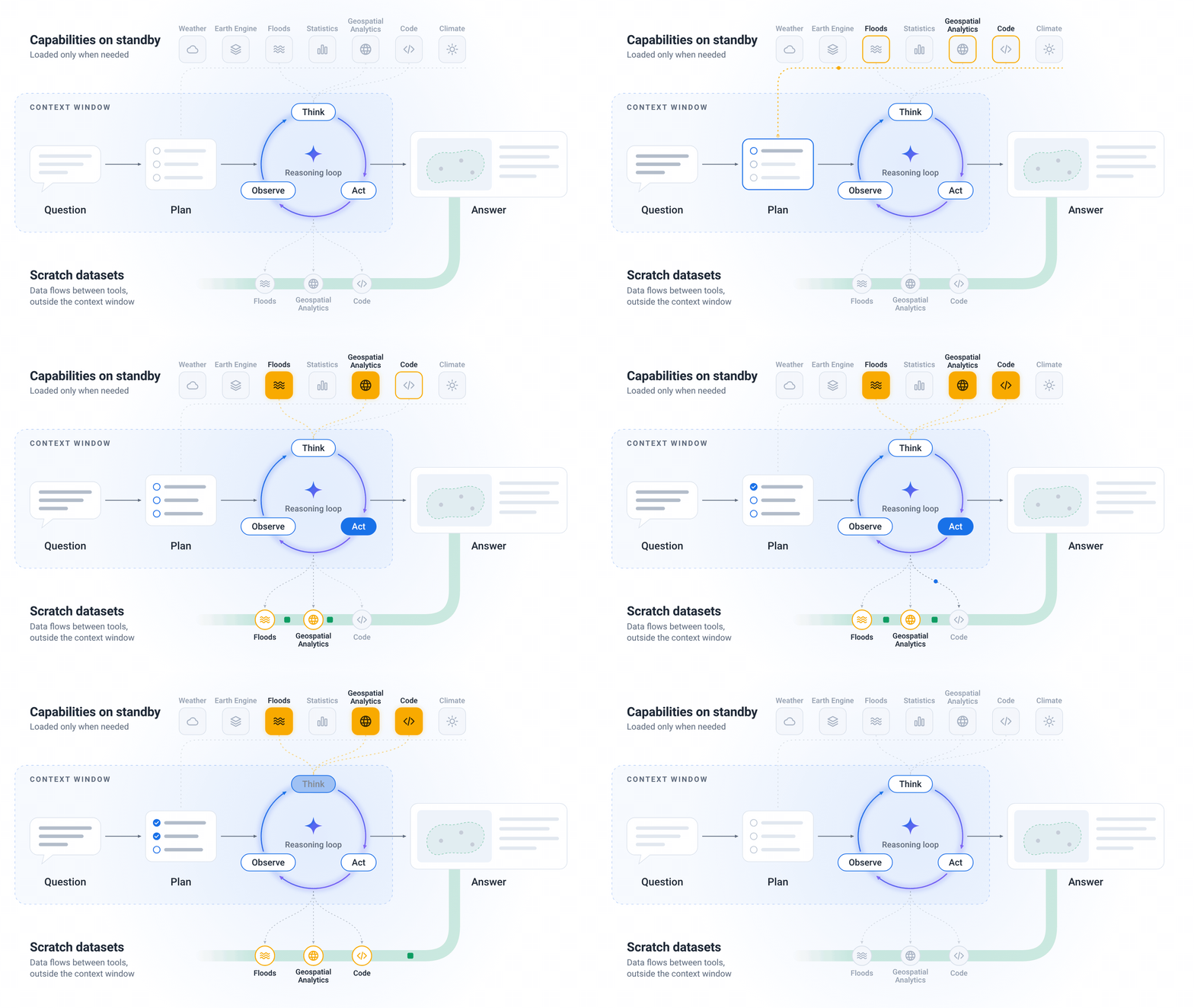
The burgeoning field of geospatial AI offers practical new ways to understand and interact with our physical world, unlocking efficiencies and insights previously unattainable. This Google Research article explores the advancement of "geospatial agents," which are AI models designed to process and reason over diverse spatial and temporal data like satellite imagery, weather patterns, and demographic shifts. The core innovation lies in their ability to integrate these complex datasets, learn from them, and then perform tasks such as predicting environmental changes or optimizing resource allocation, moving beyond simple data visualization to active, intelligent analysis. For working professionals, this technology represents a significant opportunity to automate complex environmental monitoring, improve planning, and inform critical decisions with data-driven precision. Consider a small-scale independent farming operation in central Iowa, struggling to optimize irrigation and fertilizer use; a geospatial agent could analyze local weather forecasts, soil moisture levels, and historical yield data to recommend precise watering schedules and nutrient applications, reducing waste and increasing crop output. An urban logistics startup in Los Angeles, tasked with optimizing delivery routes, could leverage these agents to predict traffic congestion based on real-time events and long-term patterns, factoring in construction, public events, and even weather to adapt routes dynamically, saving fuel and improving delivery times. Or, an internal IT team at a mid-size real estate development firm in Florida might deploy such an agent to assess potential flood risks for new properties, analyzing elevation data, historical storm paths, and projected sea-level rise to provide a more robust risk assessment for insurance and planning, thereby securing assets and streamlining compliance. To begin capitalizing on this, identify a persistent, data-rich challenge within your current operations that involves location-based factors or environmental variables. Then, experiment with publicly available geospatial datasets – such as those from the USGS or NOAA – and a basic AI toolkit to attempt a simple correlation or prediction. For instance, if you manage a small chain of retail stores, try correlating local weather patterns from public APIs with daily foot traffic data to see if a predictive model could inform staffing levels or inventory stocking for weather-sensitive products.
Source / further reading
Learn more at Google Research →